North Sea Case Studies
In the North Sea case studies, a wide variety of observational data on water properties is harmonised to shed light on scientific questions from different perspectives. This involves monitoring of ecological indicators, the carbon cycle and changes in the marine environment. One of the main objectives of the case studies carried out in this region is applying satellite remote sensing methods for the observation of matter fluxes from land to the sea and their transferability to other regions.
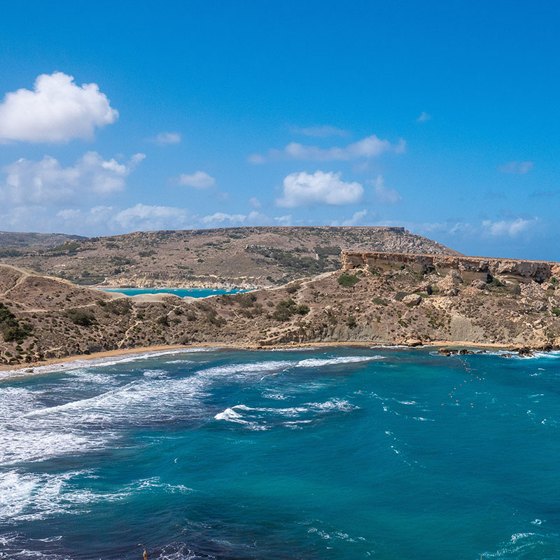
Case studies include the German Bight and Oslofjord coastal areas. In addition, the entire North Sea and Baltic Sea region with its high optical diversity is being investigated. Various data formats from multiple sources are being integrated to study land-sea interactions. Across the case studies, the aim is to demonstrate how to overcome fragmentation in water quality monitoring along the aquatic continuum from lakes and rivers to the sea by application of an optical water type-specific and neural network-based processing scheme for Copernicus satellite data. Various earth observation data will be combined with Copernicus Marine, Land, and Climate Change Services products and complementary heterogeneous in situ data.
The AquaINFRA services may be applied in resolving various research issues in the North Sea region:
Studying matter fluxes in the aquatic system – especially carbon.
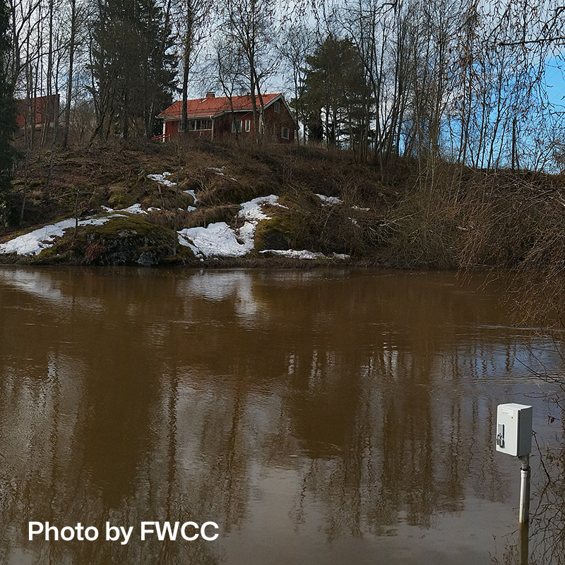
Studying the spatiotemporal extent and impact of freshwater inflows from catchment areas.
Monitoring phytoplankton biodiversity and potentially Harmful Algae Blooms.
Developing reliable and transferable satellite products for inland-coastal-ocean waters.
Using moving and stationary measuring platforms for validation of satellite remote sensing products.
Documenting anthropogenic interactions and changes in the marine environment.
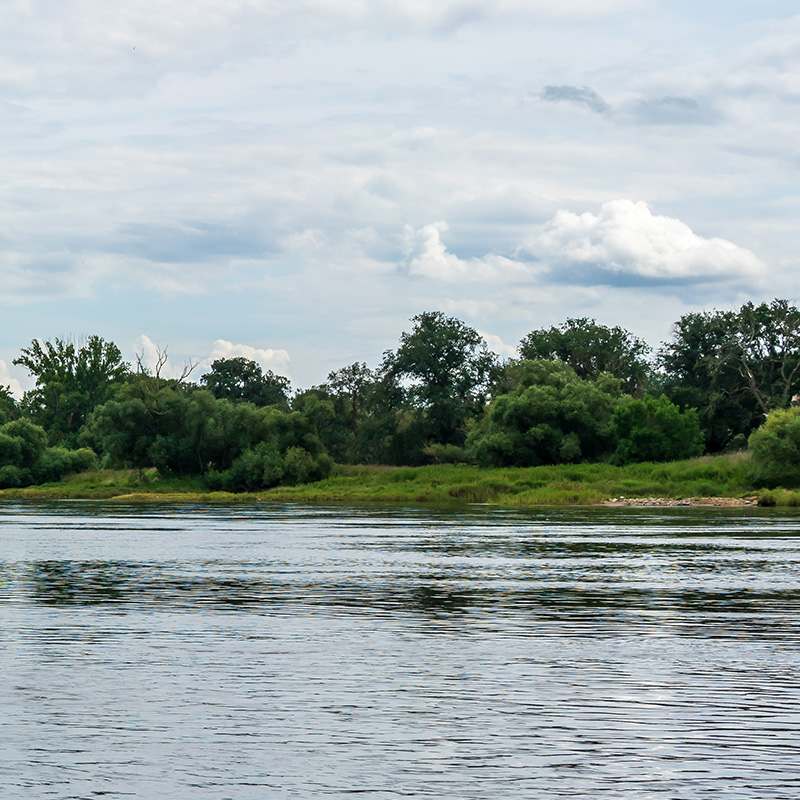
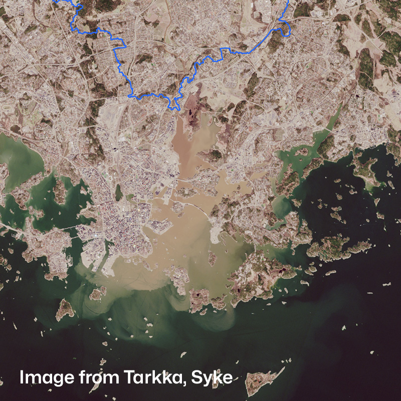
Elbe River
The River Elbe flows into the tide-influenced Wadden Sea and into the German Bight of the southwestern North Sea. This coastal region with the important port of Hamburg in the Elbe is extensively utilised by various players, which has an impact on the marine environment and makes multi-layered monitoring necessary. Using this region as an example, we want to bring together different data sources, for example from in situ measuring stations and diverse satellites, and utilise them synergistically. Scientific questions deal with the effects of human activity on the marine environment and matter fluxes, especially of organic carbon, from the Elbe into the North Sea. From the satellite perspective, the research also focuses on the spectral classification of phytoplankton diversity and the possible initialisation of warnings of harmful algae bloom.
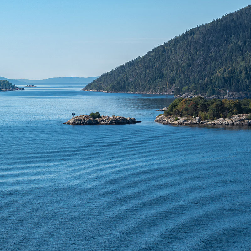
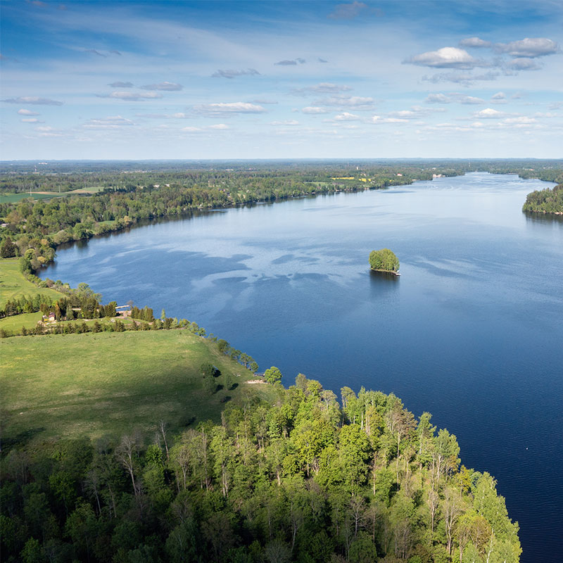
Oslofjord and Glomma River
The Oslofjord is situated in Southern Norway with narrow fjords in the north and direct connections to Skagerrak and the North Sea in the southern outer areas, facilitating a large water exchange. It is an open and dynamic fjord system with complex topographical conditions dividing it into several smaller or larger basins as well as fjord areas. Several large Norwegian rivers drain into the Oslofjord, of which the largest is the Glomma River creating a large estuary on the eastern side. The surface layer (0–30 m) is heavily impacted by freshwater input (local and advected) with a mixture of inputs from the southern central parts of the North Sea and the Kattegat. The region is used as an example for studying the land-sea interaction using a set of data sources, such as in situ sampling in rivers, river outflows and marine stations, continuous FerryBox data and satellite remote sensing with a focus on understanding the circulation dynamics and nutrient supply. Satellite data, combined with in situ measurements and river discharges, provide valuable insights into freshwater inflow impacts on ecosystem water quality.
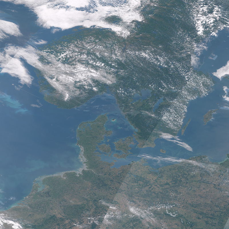
North Sea and Baltic Sea region
In order to establish transferability between different AquaINFRA case studies and to link a pan-European dimension, the view is extended to the entire North and Baltic Sea region with neighbouring catchment areas. This region has a great optical diversity of water bodies, which poses great challenges for satellite remote sensing methods and creates very different – but difficult to quantify – uncertainties in the estimation of water quality parameters. By using optical water type classification and customised water algorithms, it will be demonstrated how to overcome the fragmentation of different Copernicus services.
As part of AquaINFRA, a data set was created based on Sentinel-3 OLCI images from June to September 2023 of the entire North Sea and Baltic Sea as well as larger inland waters (>300m). This exemplary data set is intended to show how water quality parameters from oceanography and limnology can be standardised, which relevant processing levels from top-of-atmosphere to water constituents should be integrated, in which context local waters are related to other optical water classes and which adaptations to metadata are necessary for broad usability. Corresponding in situ data from the transition from the North Sea to the Baltic Sea from continuous and, since 2017, daily ferry routes between Oslo and Kiel have been published by NIVA, with metadata available via CSW and OGC.
Other Regions
Click on a region to learn more about the case studies:
Baltic Sea
In the Baltic Sea region, the case studies aim to demonstrate the use of the Architecture Implementation Plan and Virtual Research Environment to assess the state of eutrophication in the Baltic marine environment, the level of land-based nutrient load and its environmental effects and costs of measures to reduce the load and mitigate eutrophication. Datasets will include data obtained through monitoring marine environment and rivers, satellite observations, modelling and observation of effects of undertaken environmental measures, their social and economic effects and many others. In total, three case studies are being implemented in the Baltic Sea region. These case studies include the Daugava River catchment and the Gulf of Riga, the Vantaanjoki River basin and the Gulf of Finland and environmental management data in Finland and Latvia.