
AquaINFRA News
Seeing the Sea from Space: How AquaINFRA is Tackling the Challenge of North Sea Water Quality Monitoring
March 12th, 2026
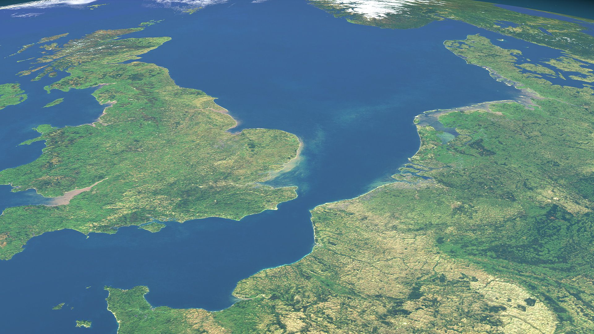
The North Sea is one of the most intensively used marine areas on the planet. Bordered by seven countries, crossed by some of the world's busiest shipping lanes, and fed by major rivers including the Elbe, Rhine, and Glomma, it supports commercial fisheries, offshore energy production, and coastal tourism while receiving agricultural runoff, industrial discharge, and urban wastewater from a catchment area home to hundreds of millions of people. Monitoring the quality of its waters is essential for managing these competing pressures, and it’s harder than it might seem…
The Problem with Coastal Waters
Satellites have transformed our ability to observe the ocean. The European Union's Copernicus programme provides free, open data from the Sentinel satellite constellation, including the Sentinel-3 mission carrying the Ocean and Land Colour Instrument (OLCI). OLCI measures the colour of the sea surface, which scientists can use to estimate concentrations of chlorophyll-a (an indicator of algal growth), suspended sediments, and dissolved organic matter -- all key parameters for water quality assessment.
In the open ocean, this works well. The water is optically relatively simple: its colour is dominated by phytoplankton. Standard processing algorithms can reliably convert satellite colour measurements into estimates of chlorophyll concentration and other variables.
But the North Sea's coastal waters are a different story. Where rivers meet the sea the water contains a complex mixture of phytoplankton, suspended sediment stirred up from shallow seabeds, and dissolved organic matter washed in from land. These substances all affect the water's colour independently, and their relative concentrations vary enormously across short distances and over tidal cycles. Standard satellite algorithms, designed for the simpler optical conditions of the open ocean, struggle in these environments. They can produce unreliable or misleading results precisely where monitoring matters most: in the productive, ecologically sensitive, and heavily impacted coastal zone.
This is a well-known problem in ocean remote sensing. But it has practical consequences for European marine policy. The Marine Strategy Framework Directive (MSFD) requires EU Member States to assess and achieve Good Environmental Status in their marine waters. Regional coordination under OSPAR (the Convention for the Protection of the Marine Environment of the North-East Atlantic) depends on comparable water quality assessments across national boundaries. If Germany, Norway, Denmark, and the Netherlands each process satellite data differently -- or if their coastal algorithms produce inconsistent results -- then regional assessments lose coherence and comparability.
AquaINFRA's North Sea Approach
The AquaINFRA North Sea case study, led by Helmholtz-Zentrum Hereon in Germany, set out to address this challenge. The approach centres on a concept called optical water types: rather than applying a single algorithm uniformly across all waters, the method first classifies each satellite pixel according to its optical properties, then applies the processing algorithm best suited to that water type.
This optical water type-specific processing, combined with neural network-based algorithms trained on in-situ measurements, can handle the transition from turbid estuarine waters to clearer offshore conditions -- the very gradient where standard methods fail. The neural network approach learns the relationship between satellite measurements and actual water quality from real observational data, rather than relying on theoretical models that assume simpler optical conditions.
The case study focused on two primary sites:
The Elbe River estuary, German Bight, and Wadden Sea. The Elbe is one of Europe's major rivers, draining a catchment of nearly 150,000 km2 across Germany and the Czech Republic before entering the North Sea through a long estuary bordered by the cities of Hamburg and Cuxhaven. The German Bight and the adjacent Wadden Sea -- a UNESCO World Heritage Site stretching along the coasts of the Netherlands, Germany, and Denmark -- represent some of the most optically complex coastal waters in Europe. Tidal flats, high sediment loads, riverine inputs of dissolved organic matter, and seasonal phytoplankton blooms create conditions that challenge any remote sensing approach.
The Oslofjord and Glomma River system in Norway. The Glomma is Norway's longest river, and the Oslofjord is one of the country's most densely populated and economically important coastal areas. The fjord's semi-enclosed geography and stratified water column create a distinct set of optical conditions compared to the open North Sea, but the same underlying challenge applies: connecting riverine nutrient and sediment inputs to coastal water quality in a way that satellite data can reliably capture.
A Standardised Dataset Across National Boundaries
The most significant outcome of the North Sea case study is a practical demonstration that consistent, standardised satellite-derived water quality data can be produced across the entire region, regardless of which country's waters you are looking at.
Using Sentinel-3 OLCI data processed through the optical water type-specific and neural network-based algorithms, the team produced a water quality dataset covering the months of June through September 2023 that spans the entire North Sea and extends into the Baltic Sea. This is not a patchwork of national products stitched together at maritime boundaries. It is a single, consistently processed dataset that treats the North Sea as what it is: one interconnected body of water shared by multiple nations.
The dataset was validated using independent in-situ data sources, including FerryBox measurements. FerryBox systems are automated scientific instruments installed on commercial ships that travel regular routes, continuously measuring water temperature, salinity, chlorophyll fluorescence, and other parameters along their track. These ship-of-opportunity measurements provide a ground-truth reference that is independent of the satellite data, allowing researchers to assess how well the satellite-derived estimates match reality in different water types and locations.
Copernicus Marine Service data was also used both as input for the processing chain and for validation, connecting the AquaINFRA analysis to the EU's operational marine monitoring infrastructure.
Why This Matters
The practical value of this work extends beyond the technical achievement of better satellite algorithms. It demonstrates three things that matter for European marine policy:
Cross-border consistency is achievable. The North Sea is governed by multiple national jurisdictions, each with its own monitoring programmes and data processing approaches. OSPAR and the MSFD require regional coherence, but achieving it has been hampered by inconsistent methods. A single, standardised processing chain applied across the entire region -- as AquaINFRA has demonstrated -- shows that comparable water quality assessment is technically feasible. The question is no longer whether we can do it, but whether we will adopt it.
The river-coast connection is visible from space. By applying methods suited to the full range of optical conditions -- from turbid estuarine waters to clearer offshore areas -- the approach captures the environmental gradients that define how river inputs affect coastal ecosystems. This supports the source-to-sea perspective that the EU Mission "Restore our Ocean and Waters by 2030" calls for: understanding that what happens in a river catchment shows up in the coastal sea.
Reproducibility through shared infrastructure. The processing workflows developed in the North Sea case study are being integrated into AquaINFRA's Virtual Research Environment built on the Galaxy platform. This means the same algorithms and processing chains that produced the 2023 dataset can be re-run by any researcher -- on new time periods, in new regions, or with updated input data. The analysis is not locked in a single research group's computing environment; it is available as a shared, reproducible scientific resource.
Connecting to the Bigger Picture
The North Sea case study does not exist in isolation. Within AquaINFRA, it connects with the Baltic Sea case study (where researchers have tracked 30-year Secchi depth changes in the Gulf of Riga), the Mediterranean case study (where coupled ocean-catchment models predict harmful algal bloom risk), and the pan-European biodiversity analysis (which assesses freshwater fish diversity across 378 catchments using the Hydrography90m dataset).
Together, these case studies are building a body of evidence that consistent, cross-border environmental monitoring -- powered by FAIR data, open standards, and reproducible workflows -- is not just desirable but achievable. The North Sea work demonstrates this for satellite-based marine monitoring; the Baltic work demonstrates it for long-term trend assessment; the Mediterranean work demonstrates it for coupled source-to-sea modelling.
All of this data and these tools are being made available through the AquaINFRA platform, discoverable through the Data Discovery and Access Service that connects over 15 European data sources, and analysable through the Galaxy-based Virtual Research Environment. As the project enters its final year, the ambition is not just to have produced good science in four regional case studies, but to have built the infrastructure that makes this kind of science routine rather than exceptional.
For the North Sea -- shared by nations that must collectively manage its health under some of the most demanding marine environmental legislation in the world -- making consistent, satellite-derived water quality monitoring routine would be a significant step forward.